0.1204
7667766266
x

Sedongpu Mass Wasting

iasparliament Logo
August 27, 2024

Why in news?

A new study highlighted the impact of high frequency of mass wasting events in the Sedongpu Gully to Northeast India.
What is mass wasting?

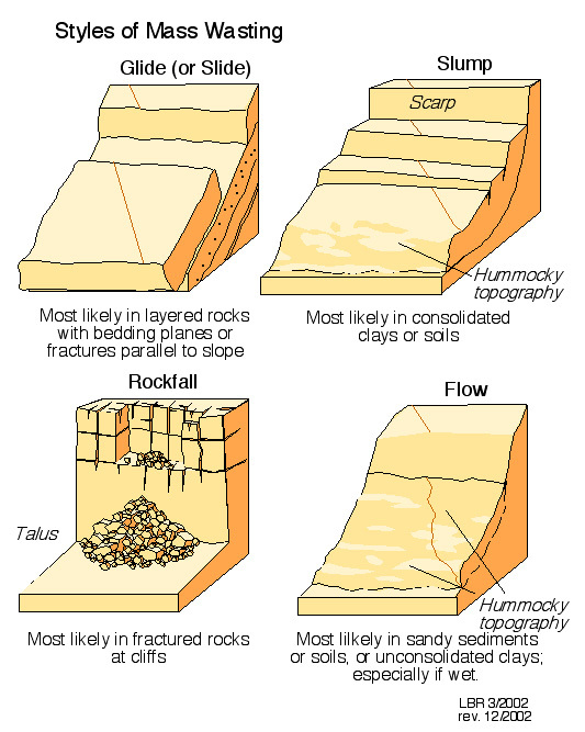
  • Mass wasting - A geological event, of gravity-influenced movement of rock and soil down a slope.
  • These events may occur very rapidly and move as a flow.
  • Causes – They are often lubricated by rainfall or agitated by seismic activity.
  • Others includes rapid snowmelt, volcanic eruption, storm waves, rapid-stream erosion, or human activities like grading a new road.
  • Types – It involves the slipping, slumping, falling and flowing of soil or rock down a slope.

               MassWasting

  • Determining criteria - There are various factors which increase the likelihood and rate of different types of mass wasting
  • Steepness of slope gradient – The steeper the slope, the greater the influence of gravity on particles.
  • Rock structure - Bedding planes and faults can increase vulnerability to movements.
  • Rock typeSedimentary and unconsolidated sediments are more vulnerable to movement than igneous rocks.
  • Level of water saturation – The greater the saturation, the lower the friction between particles.
  • Vegetation cover – Plant roots help to hold surface together
  • Human activity – Mining can cause vibrations which trigger movement/poor slope management can lead to undercutting slopes

What is sedongpu mass wasting?

Sedongpu Gully

                      Sedongpu

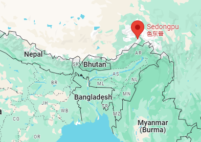
  • Location – It is located in the catchment of the Sedongpu glacier on the Tibetan Plateau.
  • Its valley, is 11 km long and covers 66.8 sq. km.
  • Gully – It is a landform created by erosion from running water, mass movement or both.
  • Great Bend – Sedongpu river drains into the Yarlung Zangbo, or the Tsangpo River by taking a sharp turn called as great bend.
  • It is close to Tibet’s border with Arunachal Pradesh, where the River Tsangpo flows as the Siang River.
  • Gorges – It creates a gorge 505 km long and 6,009 metres deep while flowing around Mt. Namcha Barwa (altitude 7,782 metres) and Mt. Gyala Peri (7,294 metres).
    • It is one of the deepest gorges on the earth.
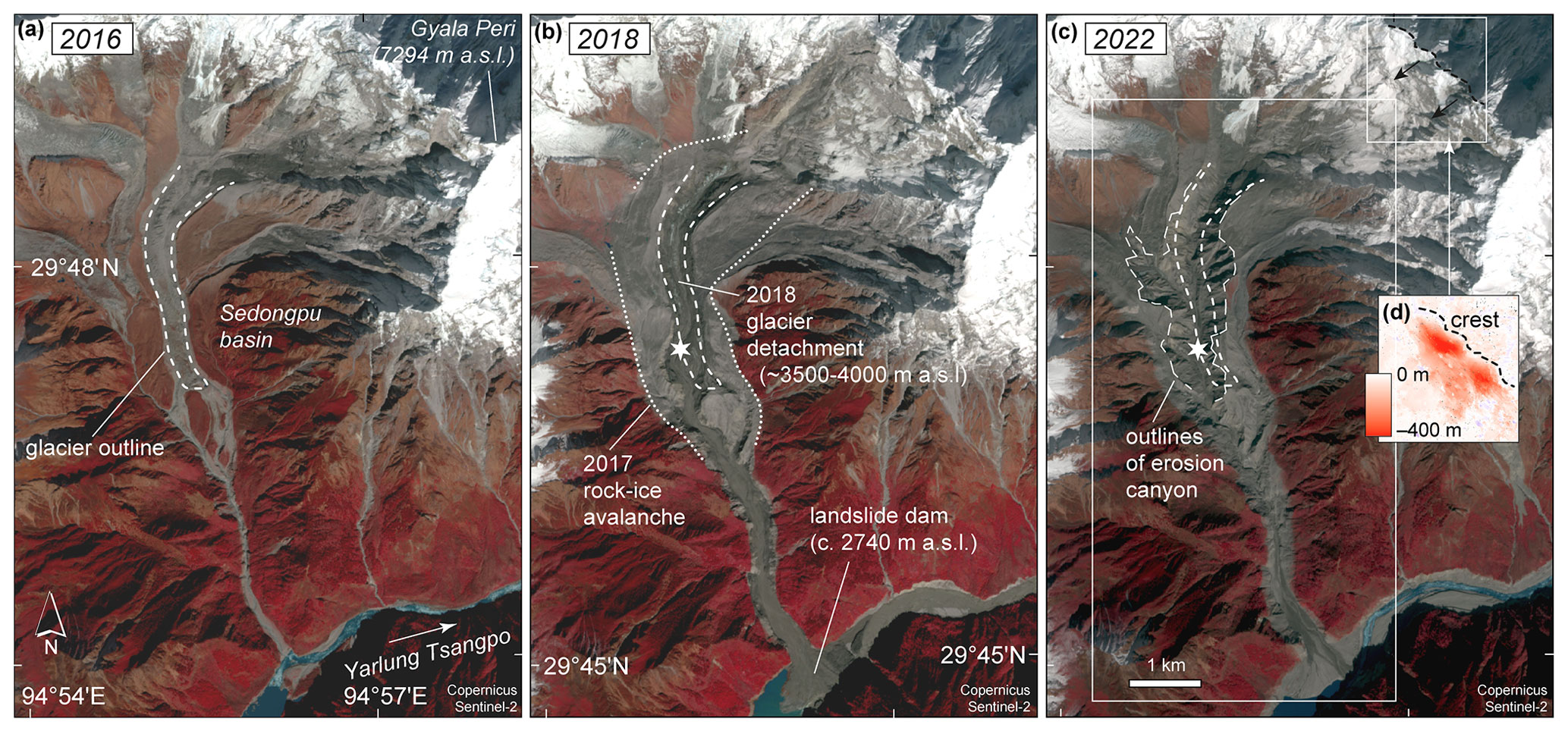
  • Sedongpu wasting – More than 700 million cubic metres of debris have been mobilised in the Sedongpu gully catchment since 2017.
  • Patterns of sedongpu wasting - From satellite images, 19 large mass-wasting events were grouped into three sub-patterns
    • Ice-rock avalanche (IRA)
    • Ice-moraine avalanche (IMA)
    • Glacier debris flow (GDF)

             Sedongpuwasting

A moraine is a mass of rocks and sediment deposited by a glacier.
What are causes for Sedongpu mass wasting?

  • Long-term warming - Annual temperature in this area increased at rates of 0.34º to 0.36º C during 1981-2018, which is higher than the global average.
    • Sedongpu basin consists mostly of Proterozoic marble whose land surface temperature ranges from -5º to -15º C, rarely exceeding 0º C before 2012.
  • Thus, there is extensive permafrost degradation occurring in the catchment, resulting in the progressive destabilisation of the slopes.
  • Dams – Big dams such as the Zangmu on the Tsangpo accentuate the threat of mass wasting.
    • China plans to set up a 60-GW project on the Tsangpo, which will have thrice the capacity of the Three Gorges project on the Yangtze, the world’s largest hydropower plant.
  • Steep Topography – Due to its steep topography, it is one of the most landslide-prone locations on the planet.
  • Geographical Instability – It is prone to earthquakes.
  • The 2017 Nyingchi earthquake destabilised the slopes and initiated the current period of instability.
  • Other factors – They have a highly fractured rock mass and the presence of large volumes of sediments from recent glaciations.

What are its impacts in India?

  • The Sedongpu mass wasting has serious transnational implications for the Tsangpo-Siang-Brahmaputra-Jamuna basin, especially in India and Bangladesh.
  • Sedimentation - Addition of major amounts of sediments to the course of the river.
    • River Brahmaputra carries more than 800 tonnes of sediment at Pandu in Guwahati, becoming more than a billion tonnes at Bahadurabad in Bangladesh.
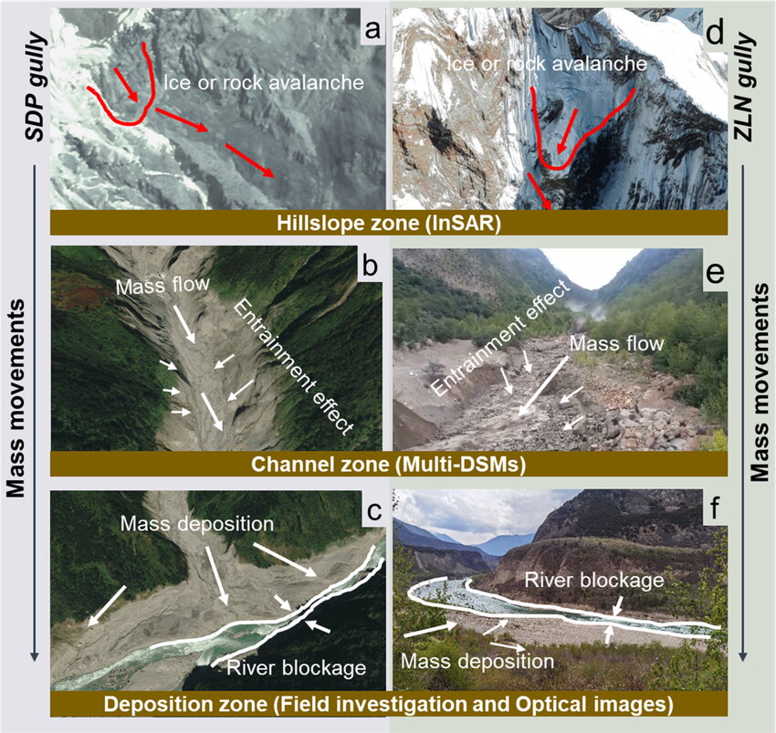
  • River Blockage – Added sediments blocks the river at different locations.

                  MassWastingImpacts

Debris flows have occurred in two adjacent gullies, namely Sedongpu Gully (SDP) and Zelongnong Gully (ZLN), since the 1950s.

  • River bank erosion - Increasing sedimentation may make the river more intensely braided in the Assam plains, which could lead to more bank erosion.
  • Flooding Hazard - The sedimentation can elevate the river beds more, accentuating flood hazards.
  • Glacial Lake Outburst Flood- Breaching of the blockages leads to catastrophic flash floods in the downstream.
  • These floods were triggered by the outburst of a dam created by the glaciated debris and rock materials generated during landslides.
  • Livelihood Impact - The channels of the river in Assam and Bangladesh may get choked with sand and silt in the lean season making navigation difficult and also affects fishing.

What lies ahead?

  • Monitor the status and trends of geophysical events leading to landslides, rock falls and other erosional processes.

Reference

The Hindu| Frequent mass wasting in Tibet could Impact India

 

Login or Register to Post Comments
There are no reviews yet. Be the first one to review.

ARCHIVES

sidetext
Free UPSC Interview Guidance Programme
sidetext