Q. How does the Equal Earth projection address some of the geographical distortions associated with the Mercator projection? Discuss its limitations as well. (150 marks, 10 marks)
Directions: Intro---- How does Equal Earth address Mercator's problems? + Limitations-----Conclusion.
Introduction:
Brief about Equal Earth projection & Mercator projection.
Main Body
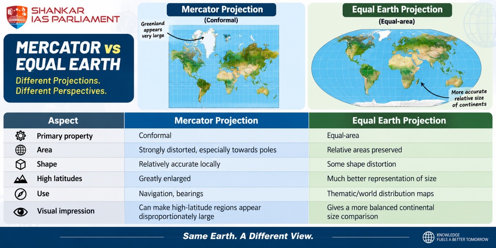
How does Equal Earth address Mercator's problems?
- Corrects the relative-size problem – Giving a better visual representation of the size of Africa, South America and South Asia compared with their appearance on Mercator.
- Reduces the visual enlargement of polar regions – Mercator increasingly inflates land areas as one moves away from the Equator; this prevents this particular area distortion.
- Better suited to thematic mapping – Particularly useful for maps showing population density, climate impacts, resource distribution and other statistical/geographical patterns.
Limitations of Equal Earth
- Shape is not perfectly preserved – Equal Earth is equal-area, not conformal & introduces some distortion in the shapes of continents and countries.
- Distance is distorted – Does not preserve actual distances everywhere – shapes and distances get distorted, with meridians curving towards the poles.
- Not designed primarily for navigation – Unlike Mercator, Equal Earth does not preserve the angular relationships needed for representing constant-bearing navigation routes. Therefore, Mercator retains an important specialised use in navigation.
- Not distortion-free – Equal Earth redistributes distortion rather than eliminating it.
- The fundamental cartographic problem remains: area, shape, distance and direction cannot all be preserved simultaneously on a flat map.
- Not necessarily superior for every purpose – Equal Earth should not simply be judged against Mercator because the two projections were designed for different purposes.
- Equal Earth is particularly useful for area-based thematic representation, whereas Mercator's historical strength lies in navigation.
Conclusion:
Give a neutral conclusion.
The Equal Earth projection addresses one of Mercator's most significant geographical distortions—the exaggerated relative size of high-latitude regions—by preserving area.