Prelims: Current events of national and international importance | Geography
Why in News?
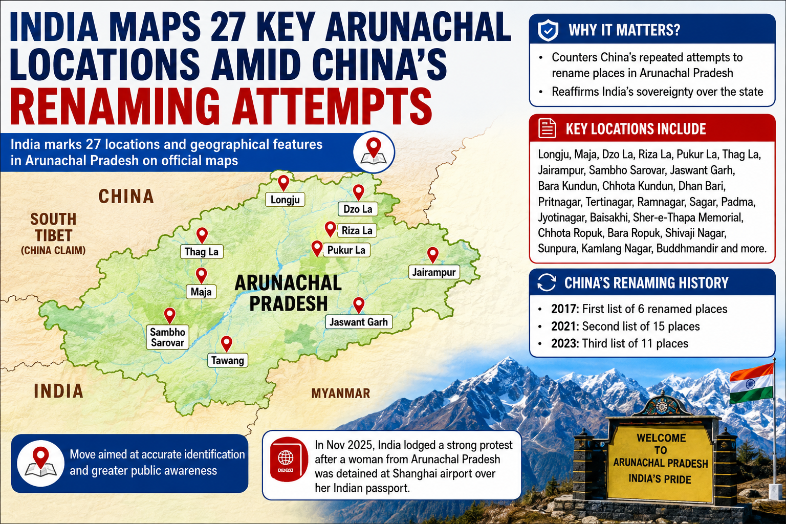
India officially updated the Survey of India map to formally identify and mark 27 key locations and geographical features in Arunachal Pradesh with their standard Indian names.
- It was a move that comes amid repeated attempts by China to rename places in the border state.
- These are including land, passes, a lake and a monument.
- It also includes Long Ju located along the Line of Actual Control.
- It was one of the earliest flashpoints between India and China in 1959 when Chinese forces entered the area.
- The list also includes Bisa village, a strategically important high-altitude mountain pass in the region, Dzo La, Riza La, and Pukur La.
- One of the most strategically important high-altitude passes, Thag La, where one of the opening battles between Indian and Chinese forces took place in 1962, has also been formally identified on the official map.
- Jairampur, an important logistics hub in the Changlang district, is known as the gateway to the eastern border region supporting movements of security forces towards eastern Arunachal and the Myanmar frontier.
- India has repeatedly described the Chinese renaming exercise as "vain and preposterous".
- And India asserted that it will not change the "undeniable" reality that Arunachal Pradesh "was, is, and will" remain an integral part of India.
Reference
The Hindu | India’s move of formally naming 27 places



