Prelims: Current events of national and international importance | Science & Technology
Why in News?
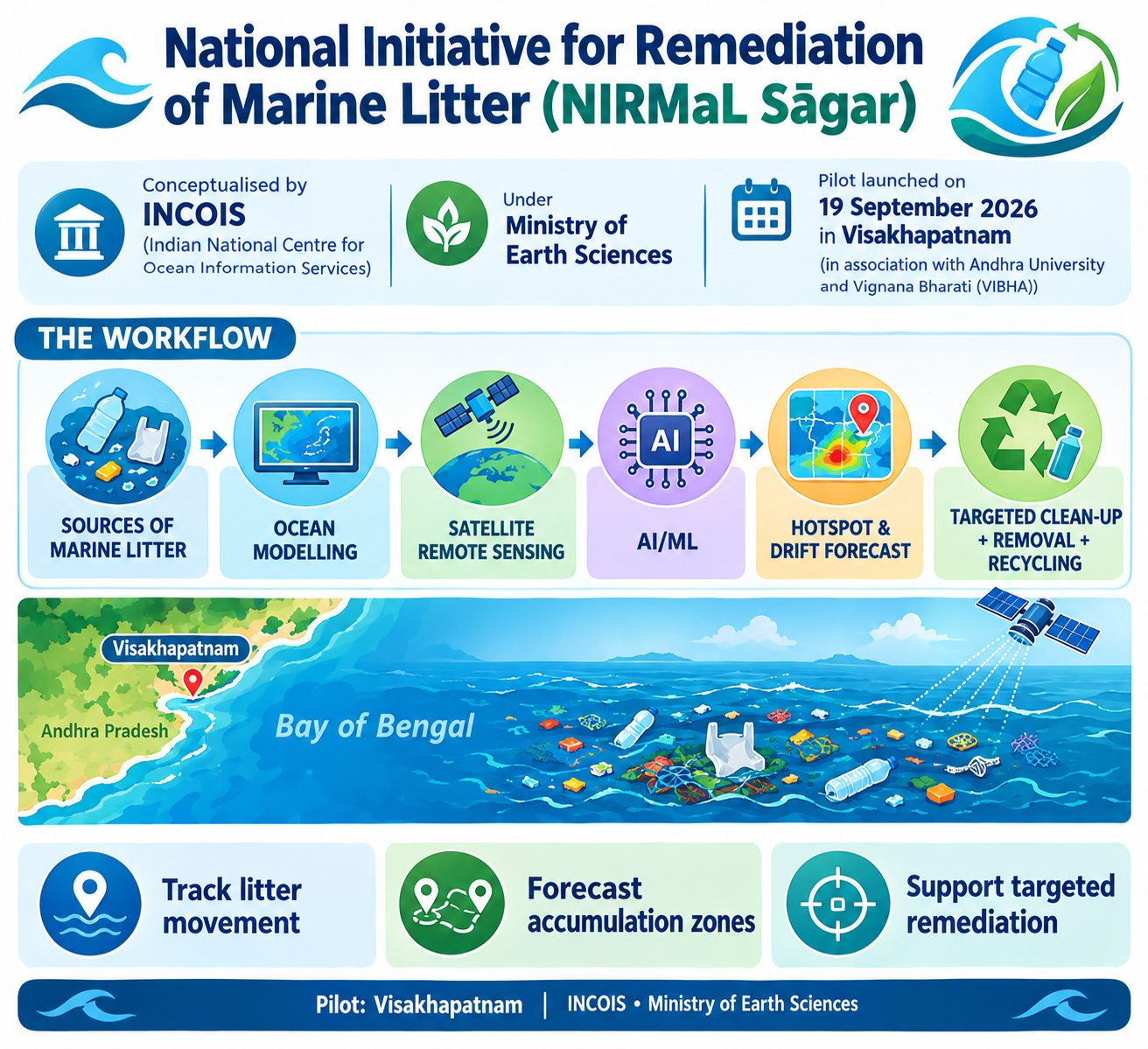
The Indian National Centre for Ocean Information Services (INCOIS), Hyderabad, announced the deployment of an integrated framework to identify, track, and forecast marine litter accumulation hotspots.
- It is India’s first integrated marine litter tracking framework.
- Launched during - The Swachh Sagar Surakshit Sagar 5.0 campaign under the National Initiative for Remediation of Marine Litter (NIRMaL Sagar).
- Pilot phase - Implemented off the coast of Visakhapatnam, Andhra Pradesh, in collaboration with Andhra University and Vijnana Bharati (VIBHA).
- Spearheaded by - The Indian National Centre for Ocean Information Services (INCOIS) under the Ministry of Earth Sciences (MoES).
Key Components of NIRMaL Sagar
- Advanced Technological Stack - The tracking framework combines ocean modelling, satellite remote sensing, artificial intelligence (AI), and machine learning (ML).
- These tools are used to identify, monitor, and forecast marine plastic litter hotspots.
- Source Tracking - Rather than just dealing with downstream beach debris, the program maps the movement of plastics, tracks how waste enters the sea (such as through open storm drains), and predicts where it will accumulate.
- Circular Economy Integration - The data gathered will support the deployment of targeted clean-up operations and explore sustainable methods to remove and recycle marine plastic waste, re-introducing it into a circular economy.
- Collaborative Action- The pilot is being executed in partnership with Andhra University and Vignana Bharati (VIBHA).
- It aims to blend institutional oceanographic research with local civic action, drawing support from the Indian Navy, Indian Coast Guard, and local fishing communities.
About INCOIS
- Established in – 1999.
- INCOIS is an autonomous body operating under the Ministry of Earth Sciences (MoES), headquartered in Hyderabad, Telangana.
- Mandate-Provides Ocean information and advisory services to society, industry, government agencies, and the scientific community through continuous ocean observations and processing of satellite and in-situ data.
- Core Flagship Services
- Potential Fishing Zone (PFZ) Advisories - Generates real-time, satellite-derived fishing maps using Sea Surface Temperature (SST) and Chlorophyll data to guide coastal fishermen.
- Ocean State Forecasting (OSF) - Predicts wave height, swell surges, surface currents, and sea surface temperature for maritime operations.
- Indian Tsunami Early Warning Centre (ITEWC)- Serves as the national Tsunami Warning Centre and a regional Tsunami Service Provider (TSP) for Indian Ocean rim nations.
- Multi-Hazard Early Warning Systems- Delivers advisories on storm surges, high-wave alarms, coral bleaching, and harmful algal blooms (HABs).
Reference
The Hindu | INCOIS to deploy AI



