Prelims: Current events of national and international importance | Geography | Disaster Management
Why in News?
A recent study has identified 219 unstable hanging glaciers in the Alaknanda basin of Uttarakhand, warning of avalanche and downstream disaster risks.
The Alaknanda Basin
- Location – Primary headstream of the Ganga in Uttarakhand.
- Elevation Range – 400 m to 7,800 m.
- Key Settlements at Risk – Mana (last Indian village), Badrinath, Hanuman Chatti.
- Critical Infrastructure – National Highway 7 (NH7), hydropower projects, pilgrimage routes.
- Concentration – 30% of hanging mass volume in Upper Alaknanda basin.
- Seismicity – The Alaknanda basin is characterized by high seismic activity, which acts as a secondary trigger for glacial instability.
- Exposure Growth – Built‑up area expanded from 8,000 sq. m (2000) to projected 150,000 sq. m (2030); population from <400 to >8,500.
The Four‑Step Life Cycle
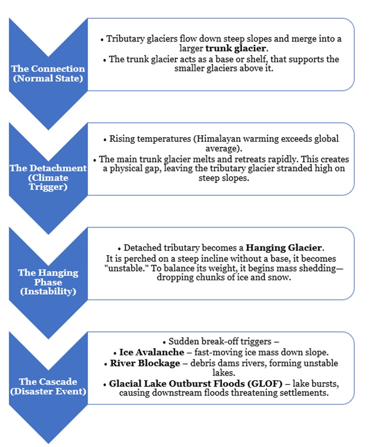
The 2021 Chamoli disaster showed glacier collapses evolving into debris flows.
- Key Analysis
- Monitoring Gap – Unlike the Alps (radar, time‑lapse cameras, early‑warning systems), the Himalayas lack systematic monitoring.
- Climate Trends – Himalayan warming in the past two decades has exceeded the global average, accelerating glacier retreat.
- Suggested Measures – Targeted monitoring of high‑risk glaciers, prioritizing resources for the most perilous zones.
Reference
The Hindu | Hanging Glaciers



