Prelims: Current events of national and international importance | Science and Technology
Why in News?
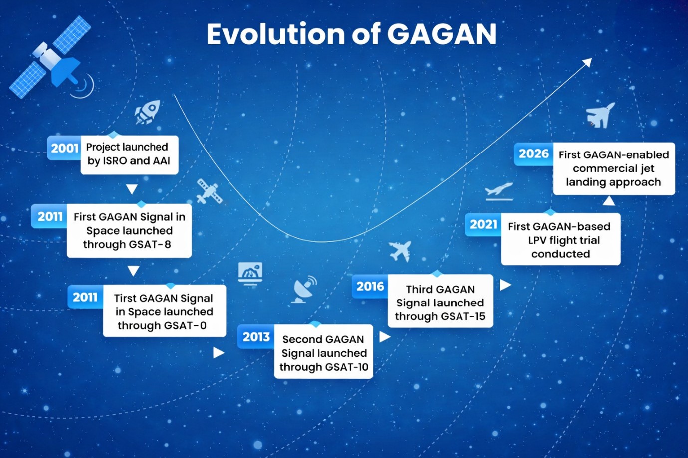
Recently, India enabled the country’s 1stsatellite‑based landing system approach on a commercial jet aircraft
Key Features
|
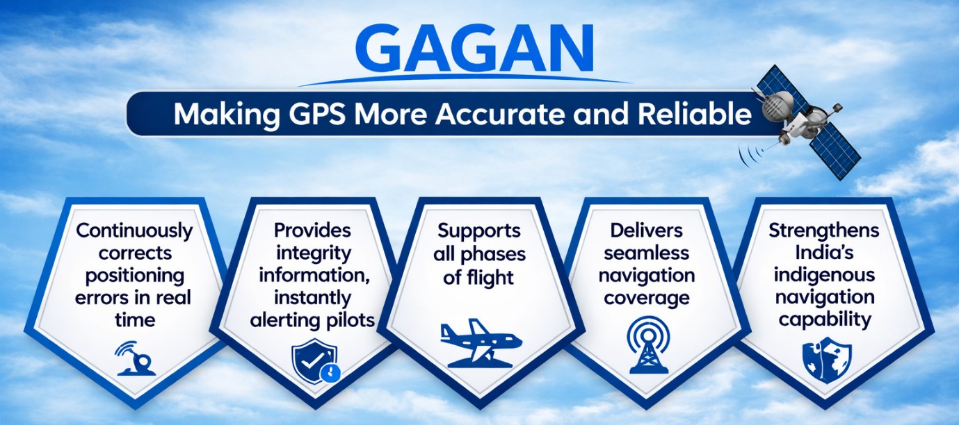
GAGAN |
NavIC |
|
Satellite-Based Augmentation System (SBAS) |
Independent regional navigation satellite system |
|
Improves GPS through real-time corrections and integrity information |
Provides positioning, navigation and timing services |
|
Supports civil aviation across the Indian Flight Information Region |
The coverage area includes India and a region up to 1500 km beyond Indian boundary |
Applications Beyond Aviation
Quick Facts
|
Reference